Weather Forecast Turmoil as 4 Major Storm Threats Collide With Critical Satellite Reductions
A high-stakes collision between coast-to-coast severe weather and sweeping federal satellite cuts has thrust American meteorological infrastructure into the global spotlight. Here is the investigative breakdown of how impending orbital cutbacks threaten community emergency readiness.
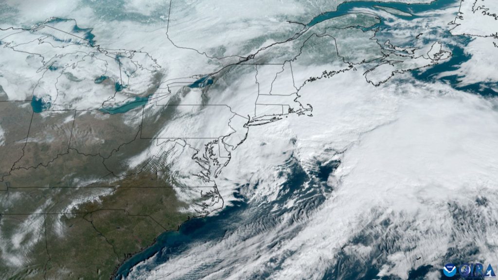
Tracking a dependable weather forecast has transformed overnight from a mundane daily ritual into an urgent national security debate across the United States. Millions of citizens woke up searching for clarity as violent atmospheric phenomena seized both edges of the North American continent simultaneously. In the East, a relentless coastal nor’easter began hammering shorelines with high surf and surging waters. In the West, dangerous tropical moisture funneling from the remnants of Hurricane Trudy triggered flash flood warnings across parched desert and mountainous terrain. Yet the true catalyst driving this sudden spike in national attention goes far deeper than typical seasonal volatility.
A stunning investigative disclosure reported by CNN revealed that the Trump administration moved to significantly slash the federal budget for planned orbital observation craft, stripping out specialized instruments and reducing the total count of next-generation meteorological satellites. According to prominent atmospheric scientists and federal modeling experts, these structural reductions threaten to push American predictive capabilities back by a full decade. The convergence of active extreme weather and long-term administrative rollback has left emergency planners, commercial logistics giants, and local broadcasters scrambling to comprehend what happens when the tools behind daily atmospheric analysis are stripped away.
Dual Coast Realities Put Regional Infrastructure Under Immediate Pressure
The urgency surrounding today’s atmospheric modeling is anchored by acute, real-world danger unfolding along American coastlines. As reported by The Weather Channel, an intense October nor’easter developed rapidly over the open waters of the Atlantic, sending powerful swells directly toward the Southeast and Mid-Atlantic shorelines. Coastal communities from North Carolina up through Delaware are currently grappling with hazardous rip currents, substantial beach erosion, and severe tidal inundation. Low-lying transportation corridors already sit submerged under saltwater, forcing municipal crews to deploy emergency pumps and barricades as gusting onshore winds pin water against vulnerable bays and estuaries.
Simultaneously, the opposite side of the country faces a radically different yet equally perilous atmospheric scenario. According to meteorologists at AccuWeather, widespread tropical moisture pulled directly from the circulation of Hurricane Trudy is driving torrential rainfall and intense thunderstorm clusters across southern California and the wider American Southwest. The sudden deluge over arid topographies and burn scars left behind by summer wildfires significantly elevates the danger of destructive debris flows and sudden flash floods. Streets throughout urban centers and desert basins have experienced dangerous flash pooling, stranding motorists and overburdening municipal drainage systems designed for minimal rainfall.
The Projected Decade Long Setback Inside Orbital Weather Operations
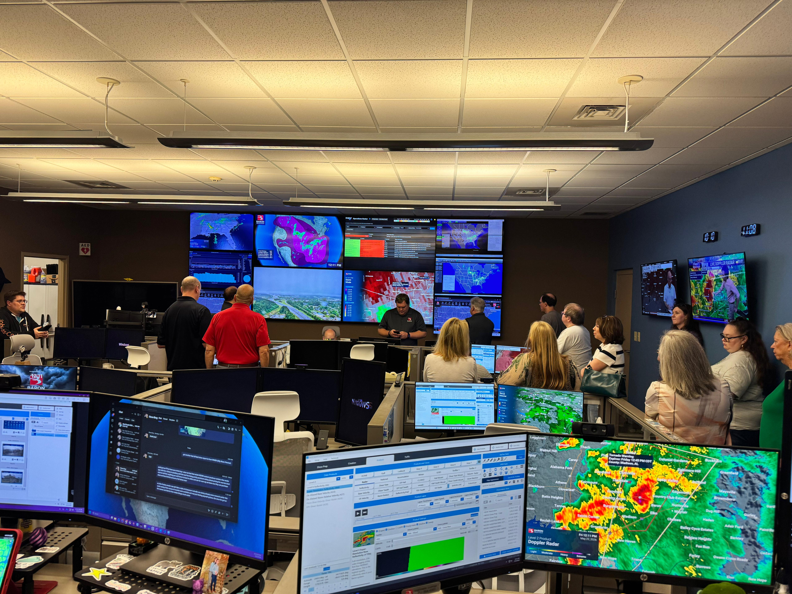
When citizens tune in to check their regional weather forecast, they rarely consider the vast orbital architecture required to calculate numerical model outputs. That invisible baseline came under intense scrutiny following CNN’s report documenting systematic cutbacks to federal satellite programs under the Trump administration. The administrative directive curtailed the procurement schedule for forthcoming polar-orbiting and geostationary satellites while systematically eliminating sophisticated onboard sensors designed to measure atmospheric moisture profiles, ocean temperatures, and upper-level wind vectors.
Atmospheric research specialists cited in the report issued a sobering verdict, noting that defunding these advanced space platforms leaves the United States dangerously behind international meteorological counterparts. For decades, the Global Forecast System operated by the National Oceanic and Atmospheric Administration has engaged in fierce technological competition with the European Centre for Medium-Range Weather Forecasts. Stripping specialized sounders and optical platforms from upcoming orbital deployments deprives high-resolution supercomputers of the core data points needed to pinpoint storm tracks. Scientists warn this operational deficit will degrade predictive lead times, turning what should be a five-day advance evacuation warning into an eleventh-hour emergency scramble.
4 Major Cracks Threatening the Future of American Atmospheric Forecasting
Understanding how orbital policy decisions impact everyday life requires analyzing the specific vulnerabilities created when observational capabilities are dismantled. Every modern weather forecast depends on the raw data stream beamed down from geostationary and polar-orbiting satellites, and reducing this sensor network compromises community safety across four distinct dimensions.
Compromised Early Warnings for Atlantic Coastal Nor’easters
Nor’easters draw their strength from intense temperature contrasts between the cold continental landmass and the warm waters of the Gulf Stream. When satellite-based microwave imagers and infrared sounders are reduced, numerical models struggle to capture sudden barometric pressure drops over the open ocean. Forecasters rely heavily on high-frequency orbital snapshots to calculate storm surge trajectories and coastal wind envelopes. Without rapid-refresh data, coastal communities face diminished lead times to protect marine assets, elevate electrical substations, and clear primary evacuation routes.
Hurricane Trudy and Escalating Pacific Moisture Volatility
The severe rainfall event sweeping through California and the Southwest highlights the volatility of tropical moisture plumes originating in the eastern Pacific. Remote oceanic regions possess virtually no land-based radar coverage, leaving meteorologists completely dependent on satellite observations to track moisture corridors. Cutting the number of orbital passes creates substantial temporal blind spots, eroding the fidelity of every extended weather forecast issued along the Pacific seaboard and making rapid-onset flash flood forecasting exceedingly difficult for emergency personnel.
The Loss of Critical Orbital Sensors and Observation Equipment
Beyond reducing the raw number of satellite hulls placed into orbit, the targeted removal of advanced sensory tools cripples scientific precision. Hyper-spectral sounders capture thousands of individual infrared channels, constructing three-dimensional vertical profiles of atmospheric temperature and water vapor. Sacrificing these instruments in the name of budgetary restraint deprives supercomputing arrays of the precise thermodynamic measurements needed to determine whether an incoming frontal boundary will produce a routine shower or a catastrophic, localized cloudburst.
The Mounting Commercial and Infrastructure Exposure
The cascading effects of diminished atmospheric intelligence extend straight into the national economy. Commercial aviation corridors depend on high-altitude turbulence detection to reroute passenger airliners safely, while freight rail and interstate trucking networks adjust routing based on predictive freezing levels and flooding thresholds. Agriculture, power grid balancing, and maritime supply chains require dependable atmospheric projections to prevent multi-million-dollar cargo losses and catastrophic blackout events.
Local Broadcasters Scramble to Translate Complex Storm Fronts
While federal policy battles unfold in agency corridors, the immediate burden of public communication falls directly upon local broadcast meteorologists. Television newsrooms such as Sacramento’s KXTV ABC10 worked around the clock delivering late news updates and dedicated overnight weather forecast segments to keep northern and central California residents apprised of rapidly advancing storm conditions. Local television stations serve as the vital bridge between complex radar telemetry and the everyday commuter trying to navigate flooded interstates or prepare for localized wind damage.
These regional broadcasts illustrate the ground-level human stakes tied to meteorological reliability. When localized downpours threaten neighborhood creek beds or unexpected nor’easter storm surges spill over sea walls, ordinary citizens do not read raw thermodynamic skew-T soundings or fluid dynamics equations. They rely entirely on their local news desk to interpret satellite loops, radar sweeps, and convective outlooks. If the underlying data fed into regional modeling systems becomes degraded due to federal space cuts, even the most seasoned local meteorologists find their predictive accuracy handcuffed by blind spots beyond their control.
High Stakes Operational Pressure Under Shrinking Margins
Maintaining high-performance public infrastructure requires continuous capital investment, unwavering technological rigor, and acute organizational accountability. When leadership falters or essential resources are pulled away from high-stakes environments, the margin for error evaporates completely. This intense operational reality is not unique to meteorology. Just as premier athletic organizations operate under fierce public inspection where every single investment must justify its valuation—a dynamic evident as Odafe Oweh Faces 5 Critical Realities Under Washington Heavy Hundred Million Dollar Scrutiny during high-leverage defensive stands—federal science agencies must deliver flawless performance under unrelenting public observation.
Operating without sufficient instrumentation weakens every municipal weather forecast, leaving public works departments and transit authorities vulnerable to unforeseen extremes. When extreme weather strikes without adequate lead time, municipal budgets are drained through emergency overtime, unmitigated property devastation, and protracted post-disaster recovery efforts. The decision to achieve short-term fiscal savings by stripping out satellite hardware represents an expensive gamble that transfers compounding financial risks directly onto municipal taxpayers, insurance carriers, and vulnerable homeowners.
The Horizon for American Preparedness in an Era of Extremes
The juxtaposition of this week’s active storm fronts with long-term technological rollbacks highlights an undeniable truth about the modern era. Climate volatility is generating more energetic, fast-moving, and moisture-rich storm systems that test the structural limits of built infrastructure. Navigating these challenges demands expanding observational resolution rather than retreating into intentional sensory blindness. The warnings issued by atmospheric scientists reflect deep concern that the United States is voluntarily relinquishing its leadership in life-saving computational sciences.
As coastal communities monitor receding tidal surges in the East and desert washes gradually drain following Hurricane Trudy’s deluge in the West, the broader institutional debate is just beginning. Federal lawmakers, commercial aerospace stakeholders, and emergency management associations will undoubtedly face difficult questions on Capitol Hill regarding the wisdom of trimming orbital budgets. Modern society runs on predictive intelligence, and ensuring that the daily weather forecast remains a shielded public service rather than an endangered luxury will determine how resilient the nation stands against the volatile skies of the coming decade.