
Coastal Flood Warning Escalates Across 4 Major Shorelines as King Tides Collide With Extreme Weather
Astronomical king tides and violent localized storm fronts have joined forces across both American coasts, swamping low-lying neighborhoods and triggering emergency flood alerts. Here is an investigative breakdown of the environmental mechanics pushing seawater into urban corridors.
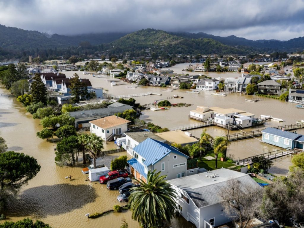
A sweeping coastal flood warning has gripped low-lying shores from the Pacific margin to the Atlantic seaboard as astronomical king tides collide with relentless weather fronts. Across multiple regions, municipal public works teams and emergency managers are confronting an aggressive inundation event that threatens transit corridors, residential foundations, and vulnerable marine infrastructure. What began as a predictable alignment of celestial mechanics has rapidly intensified into an operational crisis due to an untimely convergence of sustained onshore gales and heavy localized rain bands.
From the exposed shorelines of Southern California to the saturated barrier islands of Florida and Georgia, rising seas are pushing beyond sea walls, submerging roadways, and defying existing stormwater drainage networks. As verified by regional meteorological reports, the concurrent timing of these events across geographically distinct coastlines highlights an escalating vulnerability to combined atmospheric and tidal extremes, prompting weather service offices to maintain an active coastal flood warning across vulnerable peninsulas and barrier islands.
The Dual-Coast Surge Crisis Reshaping American Waterfronts
The geographic breadth of the current surge represents an extraordinary synchronization of coastal hazards. On the Pacific coast, exceptionally elevated tides have begun inundating beaches, boardwalks, and low-lying arterial roads across Southern California. Reporting from the Los Angeles Times emphasizes that these exceptionally high tides will swamp vulnerable shoreline zones, with environmental specialists cautioning that conditions are likely to get worse before getting better as water levels reach their peak astronomical benchmarks.
Concurrently, thousands of miles to the southeast, the Atlantic margin faces an even more volatile cocktail of weather phenomena. Broadcast meteorologists at WPLG Local 10 confirm that seasonal king tides are aggressively fueling the coastal flood threat across South Florida, sending saltwater bubbling up through subterranean limestone aquifers and inland storm drains long before high tide reaches its crest. Further north along the Florida peninsula, News4JAX documented high wind, coastal flooding, and dangerous surf throughout the weekend for Northeast Florida and Southeast Georgia, underscoring that this is not an isolated high-water incident but a widespread perimeter threat spanning multiple states.
The Astronomical Engine Driving Destructive King Tides
At the structural core of this unfolding scenario lies the phenomenon of perigean spring tides, popularly known as king tides. These extreme tidal events occur when the gravitational pulls of the moon and the sun align in syzygy while the moon makes its closest approach to Earth along its elliptical orbit, known as perigee. This gravitational alignment amplifies the ocean’s tidal bulge, producing high tides that routinely rise one to two feet higher than normal daily high-water marks.
Under calm atmospheric conditions, king tides create noticeable but generally manageable sunny-day flooding, where shallow brine spills over municipal bulkheads during peak hours and recedes harmlessly. However, when astronomical heights coincide with active low-pressure cells, onshore wind vectors, and saturated inland soils, the ocean loses its ability to drain back out to sea. In South Florida, where the underlying porous geology renders conventional gravity-fed storm gates ineffective, the rising ocean pushes water in reverse through municipal drainage conduits, inundating streets from beneath the asphalt while breaking waves attack from the seaward side.
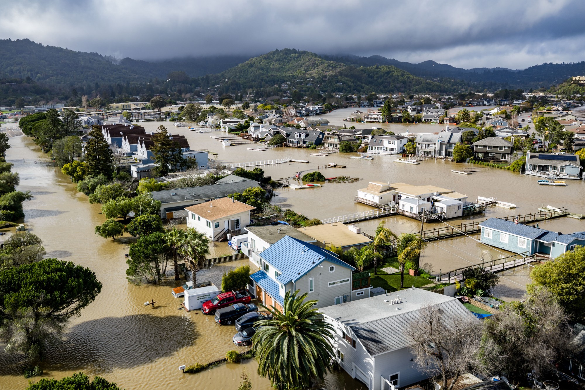
4 Critical Catalysts Multiplying Coastal Inundation Threats
The severity of the current high-water crisis is not dictated by tide tables alone. Instead, four distinct meteorological and physical variables have collided, each contributing to why a localized coastal flood warning can rapidly escalate from an inconvenience into a catastrophic hazard.
Peak Astronomical Alignment and Gravitational Surges
The foundational baseline for the current surge is the gravitational pull generated by the sun and moon reaching optimal orbital alignment. In coastal California, the Los Angeles Times identified these extreme tidal cycles as among the highest of the calendar year. Because sea level baselines have climbed steadily over recent decades, the margin between a benign astronomical high tide and an urban flood event has narrowed significantly. What was once considered an exceptional twenty-year water level is now reached regularly during autumnal perigee windows, leaving coastal municipalities with zero physical margin for error when ocean levels rise.
Gusty Onshore Winds and Dangerous Surf Stacking
Astronomical water levels represent only half of the hydrodynamic equation. Across Northeast Florida and Southeast Georgia, sustained gale-force gusts have relentlessly driven Atlantic surface waters directly onto the coast. As detailed by News4JAX, onshore winds have generated hazardous surf and elevated wave run-up, physically stacking seawater against barrier islands and estuaries. This mechanical pileup prevents low-tide drainage cycles from operating effectively, locking elevated water levels in enclosed bays and tidal sounds for consecutive days.
Understanding how moving fluid and air transfer kinetic energy is fundamental to both maritime meteorology and high-velocity sports; much like how our investigation into how Bicycle Drafting Aerodynamics Mechanics Reveal 4 Proven Secrets to Conserve Massive Energy demonstrates the power of fluid resistance, gale-force winds pushing against rising tides amplify sea surface height through intense aerodynamic shear. This constant atmospheric force has intensified the urgency of the coastal flood warning issued across the regional coastline.
Severe Localized Downpours Overcoming Municipal Drainage
While the ocean presses forward from the shoreline, tropical moisture plumes have simultaneously unleashed torrential rainfall over land. Forecasting from WPTV emphasized that coastal flooding and gusty winds would be exacerbated by substantially higher rain chances across eastern Florida. When severe downpours hit coastal communities during astronomical high tides, the fresh runoff has nowhere to go because municipal outflow pipes are already completely submerged beneath saltwater heads.
This dangerous dynamic was highlighted in early Sunday advisories from WPEC, which reported scattered downpours creating immediate flooding concerns across Palm Beach County and the Treasure Coast. The National Weather Service issued a rapid flood advisory until 7:15 AM EDT due to excessive rainfall overwhelming saturated ground. Trapped between rainfall dumping multiple inches per hour from above and king tides blocking discharge outlets from below, inland streets rapidly transformed into navigable canals.
Compromised Coastal Infrastructure and Saturated Ground Margins
The final catalyst amplifying the emergency is structural exhaustion. Across centuries-old coastal settlements, seawalls and revetments were engineered for historical high-water baselines that no longer reflect modern hydrological conditions. As saltwater repeatedly crests urban bulkheads, it saturates subterranean soils, eroding roadbeds, destabilizing underground utility lines, and degrading the structural integrity of concrete seawalls. Once the soil profile reaches complete saturation, even a minor squall causes instant overland runoff, accelerating the rate at which standing water accumulates in residential districts.
How Pacific Swells and Atlantic Squalls Create Distinct Hazards
Although both coasts face severe inundation, the physical nature of a coastal flood warning on the Pacific differs markedly from the Atlantic basin due to bathymetry and atmospheric behavior. In California, where deep oceanic trenches lie relatively close to shore, king tides manifest as massive vertical tide fluctuations combined with deep-water Pacific swell energy. As documented by the Los Angeles Times, the primary risk involves ocean waves washing over low beach berms, flooding harbors, and battering coastal bluff foundations that are already vulnerable to destabilization.
Conversely, the Atlantic shoreline along Florida and Georgia features a broad, shallow continental shelf that functions as a hydrodynamic ramp. When wind-driven squalls move over this shallow shelf, they push massive surges of water into shallow sounds, intra-coastal waterways, and marshland estuaries. The reporting from WPTV and News4JAX reflects an environment where wind-driven surge combines with sudden convective cloudbursts. Rather than dramatic breaking surf on rocky cliffs, the East Coast threat emerges as an insidious, expansive creeping flood that submerges hundreds of square miles of suburban infrastructure and cuts off island evacuation routes.
Navigating the High Tide Cycle and Mitigating Water Damage
When meteorological authorities activate a coastal flood warning, residents living in low-lying zones must treat tidal schedules with the same tactical vigilance typically reserved for tropical systems. The immediate physical risk extends beyond property damage; saltwater conducts electricity, corrodes vehicle wiring harnesses almost instantly, and conceals open manholes and storm debris on flooded roadways.
Mitigating damage requires anticipating the exact windows of peak tide, which occur twice daily during king tide cycles. Municipal authorities across affected jurisdictions continue to deploy temporary diesel-powered bypass pumps, install inflatable plug dams within vulnerable sewer mains, and distribute sandbags to prevent wake damage from emergency vehicles traversing flooded streets. While astronomical tides will gradually subside as the moon pulls away from its orbital perigee, the broader lessons of this weekend remain stark. The collision of celestial alignment, changing baseline sea levels, and unpredictable localized storms underscores that the coastal fringe must adapt rapidly to a new era of relentless inundation.